
Altitude: 152 m a.s.l.
Area: 14 sq km
Distance from Imperia: 60 km
Inhabitants:
in 1881: 1558
in 2017: 224
Patron Saint Day: June 13th - Sant'Antonio da Padova
Information: Municipality tel. 0184 222333
Olivetta, which is equipped with a fortified castle of which the ruins remain at the top of the hill in today French territory, had to repeatedly defend itself from the incursions of the Savoys, who in 1451 also resorted to the gang of the brigand Giovanni Brondetto of Sospello who with one hundred and sixty men conquered the village.
Only after a siege lasting about one year, Enrichetto Doria di Dolceacqua - governor of the territory on behalf of Genoa - regained Olivetta.
The Savoys periodically continued to try again intensifying the attacks starting from July 1625, when the great war with Genoa began.
In 1672, the Piedmontese gave it another try with Don Antonio of Savoy, who besieged Olivetta and threatened to intervene with two cannons and twenty-five thousand men.
The commander Gerolamo Maria Gastaldi replied: "Let them come, we want to fight", but fortunately arrived the news of the armistice, which would result in the peace treaty signed the following year, and the Savoys thus retired without harm.
As a reward for its heroic resistance, the village obtained exemption from taxes by Genoa.


Visit of the town
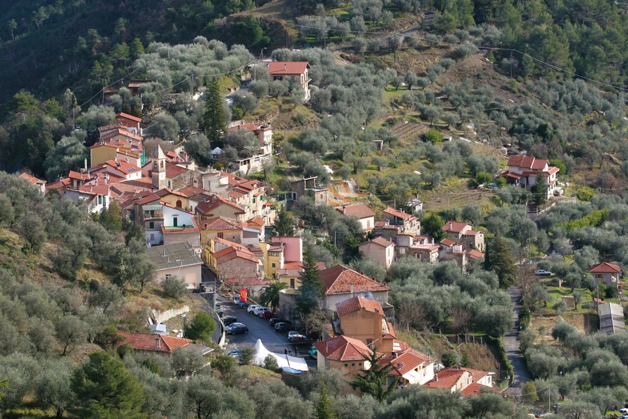
Today Olivetta San Michele is a small center with well-restored houses and a railway station located in the hamlet of Bassa Nova, without monuments of particular interest; the church of Sant'Antonio da Padova has a large fresco in the apse and the statue of the saint on the facade.
The oratory is a modern building where is also located the local Tourist Office.
Going back, if at the intersection with State Road 20 you turn left, you’ll reach the border crossing point of Fanghetto near which there is a beautiful Roman bridge.
Continuing, after eleven kilometers you’ll arrive to Breil and after another fifteen to San Dalmazzo di Tenda, from which you can continue on the narrow road following the signs to Les Mesches-Casterino.
After nine kilometers of narrow hairpin bends you’ll reach the area with the large artificial lake of Mesches. Here you can leave the car and take the "route jeepable" on the left which goes up the Vallone della Miniera venturing into the Valle delle Meraviglie with its mysterious graffiti on the slopes of Monte Bego.
Roughly chiseled on the rocks are over fifty thousand drawings, the oldest of which date back to over three thousand years ago.
A first peculiarity is constituted by the way of representation: oxen and plowing scenes are in fact reproduced as seen from above, i.e. in plan; but the real mystery of these engravings are the numerous drawings that have remained undecipherable up to our days.
And if the irregular juxtaposed polygons can make one think of land maps or celestial maps or maps of villages or fences with flocks, other drawings do not offer the slightest clue to make us understand what they could represent; the charm of the unknown is indeed the driving force that makes us walk through and explore these places.