
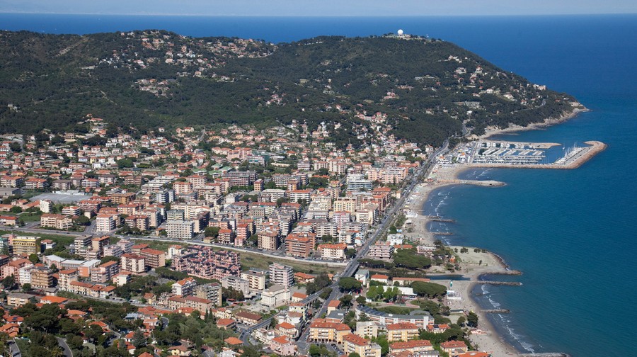
Altitude: 10 m a.s.l.
Area: 31.61 sq km
Distance from Imperia: 16 km
Inhabitants: in 1881: 1235 - in 2017: 7531
Patron Saint Day: May 3rd - Saints James and Philip
Information: Municipality phone 0182 6811236
After visiting Cervo you can return to Via Aurelia and head to the east; at the beginning of the town of Andora head towards the Clavesana castle and, at the traffic light, turn left and follow the signs to the highway.
After a couple of kilometers, at the roundabout before the tollbooth, take the right and then the first road on the left; at the first junction continue keeping the right on the dirt road, turning left at the next intersection where a floricultural farm stands, reaching after a few hundred meters the parking lot from which you can go up on foot taking the left.
The mule track ascends towards the Clavesana castle and passes through the well-fortified 13th-century tower-gate from whose sides set off the now-disappeared walls that protected the overlying castle: the different typology of the two stone arches, a pointed arch the initial one and a round arch the opposite one, remind us of the uncertainties of the period between Romanesque and Gothic.
On the right wall of the cross vault that supports the tower, the fourteenth-century fresco "Annunciation" overlooks the arch through which carried out its controls the guardhouse placed in the adjacent room, of whose roof traces remain on the external wall.
Inside the tower, built on two floors with squared stones of Capo Mele as the nearby little church, the defenders entered through the two windows with ladders that were then removed making the fortress impregnable; the upper part was rebuilt in the seventeenth century with Ghibelline battlements and a cusp in the center of the terrace.


Visit the town
Next to the tower stands the evocative church of Santi Giacomo e Filippo, built in the first half of the 13th century, which is the most typical example of Ligurian religious architecture in the late Romanesque period.
Already Gothic are the hanging arches on the facade, on the sides and on the three apses; the unequal mullioned window and single-light window on the facade; the wide polyphora in the center; the lateral portal with double access flight of steps and the internal pointed arches.
On the other hand the Romanesque character of the general layout remains, in the splayed portal (with a very deteriorated fresco in the lunette), in the massive internal stone columns and decorated cubic capitals and in the size and distribution of the windows on the sides: three small single windows open only on the northern wall, in shadow, while the south wall exposed to direct sunlight is totally deprived of them, thus leaving the interior in a cozy dim light, as in the most classical Romanesque tradition.
The white and black bands that alternate on the arches of the facade testify to the Genoese influence derived from Pisa.
The evocative, now deconsecrated church is home to concerts and summer art exhibitions.
One hundred meters upstream rise the ruins of Castello dei Clavesana whose first nucleus dates back to the end of the 11th century.
The structure, surrounded by other medieval ruins, has a polygonal plan to the north and a quadrangular plan to the south where opens the pointed arch portal in large square ashlars.
The entrance arch leads under the cross vaults of the loggia, beyond which was the central two-story building of which today only the perimeter walls remain; at the center of the clearing is the base of the quadrangular six-meter wide tower, dating back to around the year 1000 and of probable anti-Saracenic origin, which constituted the first fortress in the area.
Opposite the entrance to the castle is the coeval church of San Nicolò which has preserved the upstream side of the original Romanesque building; the portal is from the Gothic period.
Returning to the parvis of the church of Santi Giacomo e Filippo, walk along the small road on the left to visit the nearby small nucleus of sixteenth-century houses; past the vault there is on the left a door with an architrave in carved stone and then a mullioned window whose central column comes from the façade of the church, while on the right there is an archivolt that ends with the ogival stone arch of the gate that once closed the western access to the village.
Going back towards the church, past the last houses, take the downhill path on the left which leads to the Roman fountain in about two hundred meters.
The basin, built in squared stones directly above the spring that feeds it, is more than four meters deep and just as long, protected by a round-arched vault covered with stone chips.
In front of it passes a section of Via Julia Augusta (13 BC) that descended from the hill heading towards the bridge; the natural spring favored the establishment there of a "Mutatio", i.e. a station where travelers could change horses and rest, halfway between the settlements of Albium Ingaunum (Albenga) to the east and Servo and Lucus Bormani (Cervo and Diano Marina) to the west.
From here, looking upstream, you can catch a glimpse of the tower and the church.
Going back, from the road that takes you back to the church, the Roman bridge (later called “di San Giovanni”, i.e. St. John's) is clearly visible down in the valley; on this bridge passed Via Julia Augusta heading to Rollo.
One hundred meters long and two meters wide, the bridge crosses the Mérula stream with ten arches, seven of which with a six-meter rope supported by piers with double spurs made of squared stones of clear Roman period; the first two on the west and the first one on the east were rebuilt much larger in the Middle Ages in the typical humpbacked structure.
From the church go back by car along the road already traveled, go around the roundabout and then take the Provincial Road on the right which, controlled on the hills to the left by two circular towers against Saracenic invasions, goes into the valley along the Merula river.